Same systems. Different tech.

scroll
Territorial data. Human motion. AI-powered tools.

We build territorial intelligence software that connects human mobility dynamic data to the static systems — turning what's fragmented into personalized platform-tools for organizations, planners, and the people navigating mobility.

One engine. Three applications.

The Spatial Intelligence Engine (SIE) applies the same territorial intelligence methodology across three domains of human mobility. Rotate to explore each application.

SIE · Spatial Intelligence Engine
86
SIM
LIVE
99%
VTM
BETA
$
MTK
MVP READY
SIM — Space in Motion
Territorial scoring for urban integration planning
Institutionally validated · Aachen

Space in Motion

(SIM) · First venture application of SIE

A territorial scoring system that reads existing spatial data and returns a single, defensible intelligence layer — so organizations, planners, and people navigating human mobility can finally act on what the territory already knows.

The methodology includes a profiling system that recognizes different populations navigate the same territory differently. Each profile applies indicator weights calibrated to documented needs — because the same street means something fundamentally different depending on who is walking it.
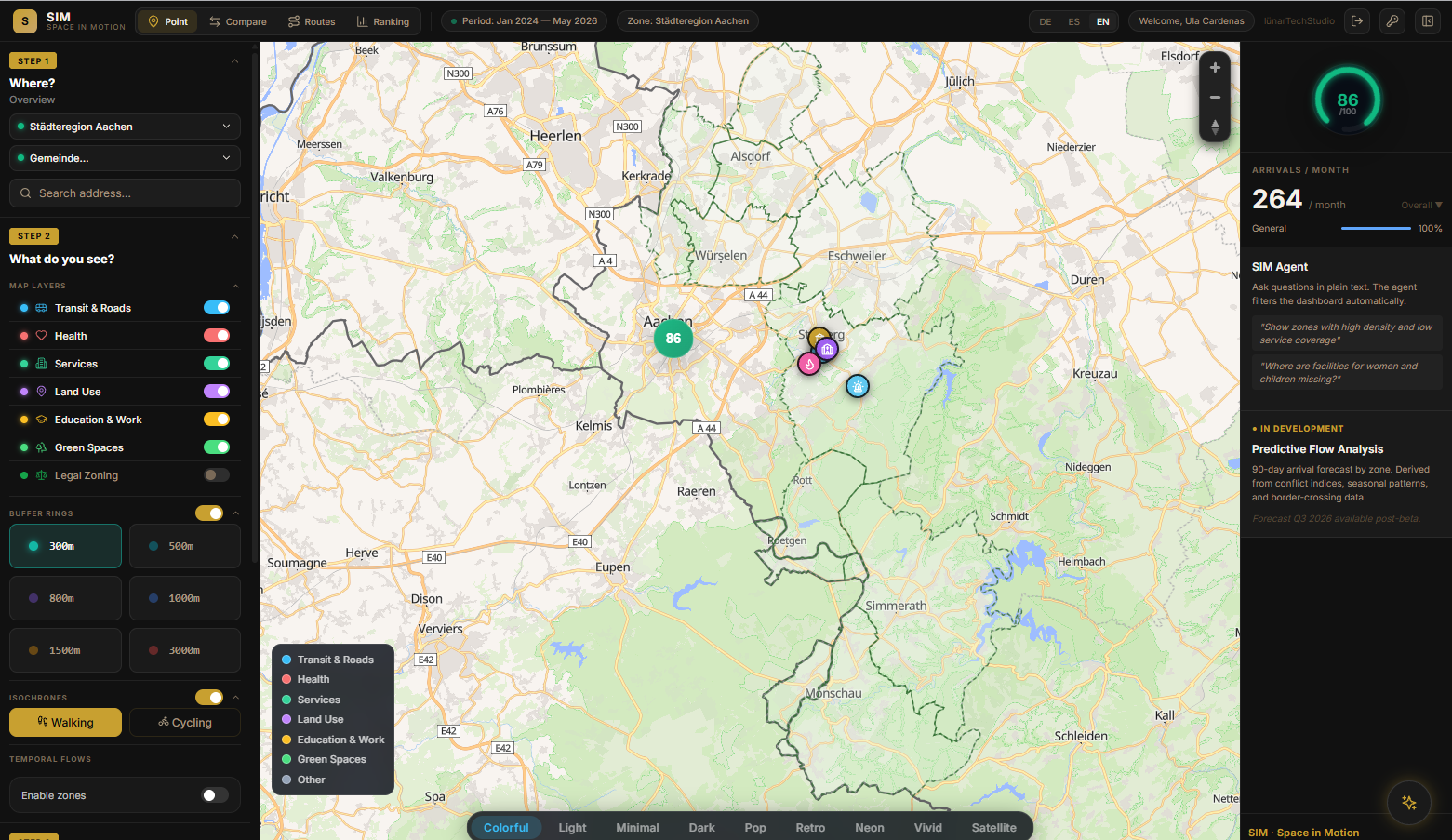

SIM · Space in Motion · live interface Live
SIM interface — Städteregion Aachen, territorial score 86/100
SIM · Methodology
7 variables, 21 indicators transport, health, education, green space, services, legal zoning, community infrastructure. Each weighted, traceable, defensible.
Profiling methodology recognizes different populations navigate the same territory differently. The same street means something different depending on who walks it.
Open, reproducible data OSM, Geofabrik, GTFS, Geoportal NRW. Every source citable. No black box.
Visibility without surveillance SIM reads territorial conditions, not individuals.
hover to reveal methodology
Organizations & NGOs
Territorial evidence for placement decisions that must be defensible, reproducible, and auditable.
DRK · Caritas · NGOs · AMIF-ready
Municipalities & Planners
Scoring that turns zoning, services, and transit access into decisions a council can stand behind.
Stadt · Gemeinde · Urban planning
The People
The same intelligence that helps organizations plan can help people navigate — before they even arrive. Where are the services? Which neighborhood fits? What does this city look like?
Immigrants · Pre-immigrants · People-first
Ecosystem
One SIE engine. Three applications. Institutionally validated. Research origin RWTH Aachen. Built for the methodological language AMIF and ESF+ require.
Investors · EU grants · Research partners
live data
Data moves in real time
0
data points processed · Aachen region
filter systems
Interfaces respond to you
transport
health
education
green spaces
services
housing
3 layers active · score: 74/100
territorial indicators
Urban data, made readable
transport
78
health
61
education
84
green
43
services
67
legal
55
community
71
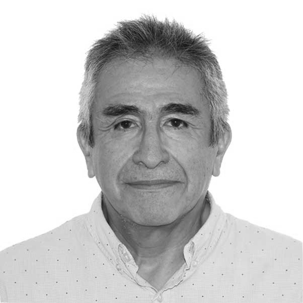
Ursula CardenasVignes
Founder & CEO
Ursula CardenasVignes
Architect · Urbanist

Architect and urbanist. Creator of Architechnology — a proprietary spatial analysis methodology developed through three years of field research at RWTH Aachen. The scientific core behind SIM.

Her work starts from a simple observation: the data that makes cities legible already exists. It sits fragmented across municipal databases, transit feeds, zoning archives, and institutional records — spatially disconnected, institutionally siloed, and invisible to the communities it concerns.

Architechnology is the method that connects it. Institutionally validated with a public institution in Aachen. Built for replication across city regions.

"Visibility without control. The data exists. The communities are real. The system just wasn't designed to see them."
Bachelor Architecture · UPC Peru
MSc Transforming City Regions · RWTH Aachen
(..lTS founder, backed by EXIST Women · digitalACCELERATOR Aachen
Partner Institutional validation · Aachen
Languages Spanish (native) · English C1 · German B2/C1
Luis Cárdenas Ojeda
Technical Lead
Luis Cárdenas Ojeda
CTO · Software Architect · Specialist in Applied AI

Software architect with 40+ years building complex technological ecosystems across regulated sectors — fintech, microfinance, government, mining, and energy. Designs and builds the full technical infrastructure behind lünarTechStudio: spatial data pipelines, LLM orchestration layers, vector search systems, and the scoring engine at the core of SIM.

Creator of Minaro — an enterprise AI kernel for session management, contextual memory, advanced prompting and RAG — and Monetrika, a full fintech + AI distributed ecosystem. Brings production-grade engineering discipline to civic tech infrastructure that institutions can actually trust.

Go · Python · C# · .NET RAG Pipelines · LLM Orchestration · LangChain · LangServe PostgreSQL + pgvector · MySQL · NoSQL Microservices · SOA · Distributed Architecture PCI · EMV · 2FA · Cryptographic Models OSM · Geofabrik · GTFS · Flask
MIT Professional Education · Boston (2017–2018)
Master Organizational Leadership — EADA Business School · Barcelona (2012–2013)
MBA Tulane University · A.B. Freeman School of Business · New Orleans (2010–2011)
MoM Master of Management — Tulane University (2010)
MBA Pontificia Universidad Católica del Perú · Lima (2009–2010)
Diploma Computer Science — Universidade Presbiteriana Mackenzie · São Paulo (1985–1986)
Engineering Industrial — Universidad Nacional de San Agustín · Arequipa (1980–1985)
Languages Spanish (native) · English C1 · Portuguese B2 · Italian B1 · French B1
Let's build
something
that matters.
ursula@lunartech.studio
message sent. we'll be in touch.
error sending message. please try again.